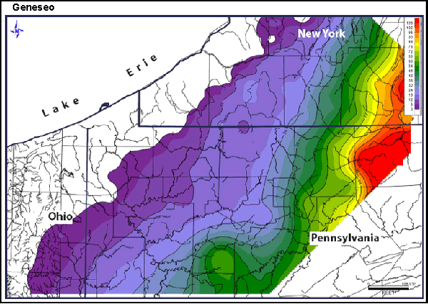
An isopach map is a map that shows the variation of thickness within a tabular unit or stratum. Isopachs are contour lines of equal thickness over an area. They are used in stratigraphy, sedimentology, structural geology, and volcanology. This map is of the Geneseo Shale (thickness in feet).
No comments:
Post a Comment